Nestled in the heart of the Peak District, Edale is a seventh heaven for walkers. The village puts you just steps from some world-class trails, including the iconic Pennine Way. Not to mention dozens of other routes that criss-cross the region and take you through a patchwork of rolling hillsides, rocky outcrops and centuries-old stone villages. We have complied our definitive list of Edale walks for 2021.
As well as 555 square miles of pristine countryside to explore in Peak District National Park, you’ll find plenty of other trails outside the park’s borders. There are options to suit hikers of all levels, whether you’re bringing along the whole family or training for the London Marathon. We’ve rounded up a few of our all-time favourites below:
Table of Contents
Getting to Know Edale
Before we dive in, let’s take a moment to introduce Edale, a tiny village with a big reputation. With a population of less than 500, Edale is by no means a bustling town. That said, it does tick all the boxes when it comes to cafes and pubs. Other services worth mentioning include a train station with good connections to Sheffield and Manchester, as well as public bathrooms and a Visitor Centre. We recommend stopping by the latter to find out about trail conditions, weather forecasts and other information that can change daily.
Introducing Peak District National Park
Edale is best-known as a launchpad to Peak District National Park. One of Europe’s most beloved outdoor destinations, the park was founded in 1951 and is laced with hundreds of walking trails, many starting and ending in Edale.
Fun fact for all you first-timers to Peak District. Despite the evocative name, the region is not studded with peaks. In fact, there’s not a peak to be seen. Instead, the landscape is defined by undulating hills, windswept moorlands, deep valleys and picturesque lakes. Limestone dales and gritstone escarpments give the park a rugged feel, but still no peaks. Historians theorise that the region was named after the Pecsaetan, an ancient Anglo-Saxon tribe who inhabited the are between the 7th and 9th centuries.
Now you know a bit more about Edale and Peak District National Park, let’s get stuck into some of our favourite walks, hikes and rambles:
Edale Low Level Circuit
Gaining just 130 kilometres of elevation, the Edale Low Level Circuit is a perfect introduction to hiking in Peak District. It takes around two hours to complete, making it ideal for families with toddlers in tow. You’ll start by heading to the official Pennine Way start point opposite the Old Nags Head Pub. Follow the path to Upper Booth, a tiny hamlet surrounded by rolling countryside. In summer, there’s often a tiny shop where you can indulge in a scoop of handmade ice cream. The trail then loops back via Barber Booth and brings you back to Edale.
Length: 3.5 miles
Average time to complete: 2 hours
Starting point: Edale Train Station
Mam Tor
At 517 metres above sea level, Mam Tor promises stunning views without too much elevation. The name translates to Mother Hill, a nod to the fact that frequent landslides on the eastern face have created a series of smaller hills beneath the main peak. The walk starts with a short climb up a staircase. After passing through the woodlands the trail opens up and you’ll start ascending the stone steps that lead up Mam Tor. From the top you’re rewarded with sweeping views over the Vale of Edale, Hope Valley and Peveril Castle in the distance.
On a clear day the views stretch all the way to Kinder Plateau. If conditions are good, you might even spot paragliders flinging themselves off the hillside. If you’re feeling energetic consider tacking on Back Tor, an up-and-down route that adds an extra mile or so to your journey but unlocks fantastic views over the rear ridge.
Length: 3 miles
Average time to complete: 2 hours
Starting point: Mam Tor National Trust Car Park
Kinder Scout
There are a few different ways to summit Kinder Scout and the route via Grindsbrook Clough is definitely a favourite. Starting in the village centre, the route takes you over a narrow wooden bridge and through a sun-dappled woodland before starting to climb Grindsbrook Clough. The trail can get pretty rocky so it’s best to come prepared with a good pair of boots. Be ready to scramble as you approach the summit, with a cairn marking the spot.
Hiking up to Kinder Scout via Jacob’s Ladder is another option and takes you along the well-worn Pennine Way. Carved into the hillside by an 18th-century farmer called Jacob Marshall, the “ladder” takes you up Edale Head and up to the moorland plateau. Stop for lunch and take some time to soak in the views before starting the thigh-burning hike down.
Length: 8 miles
Average time to complete: 5 hours
Starting point: Old Nags Head Pub
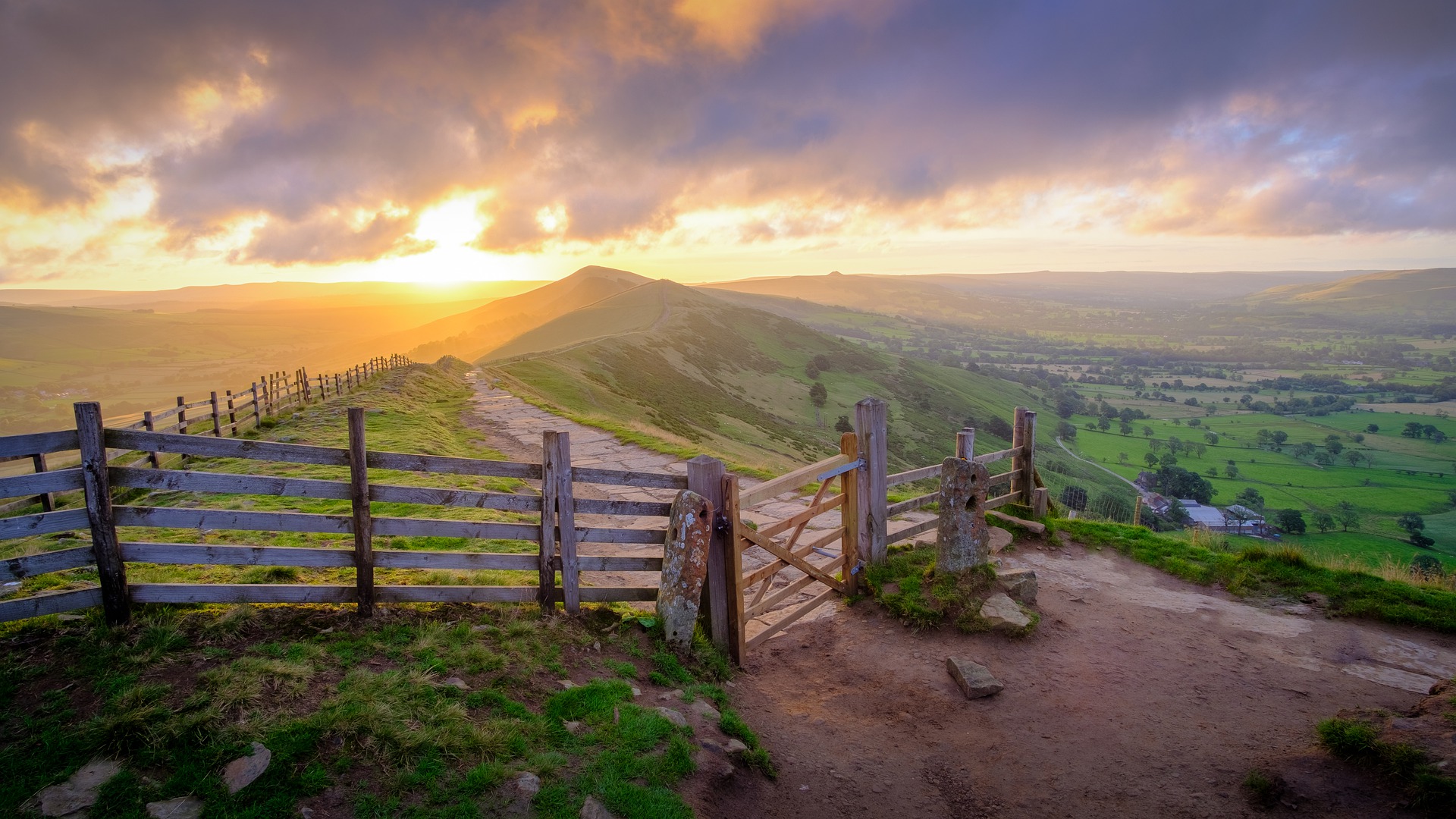
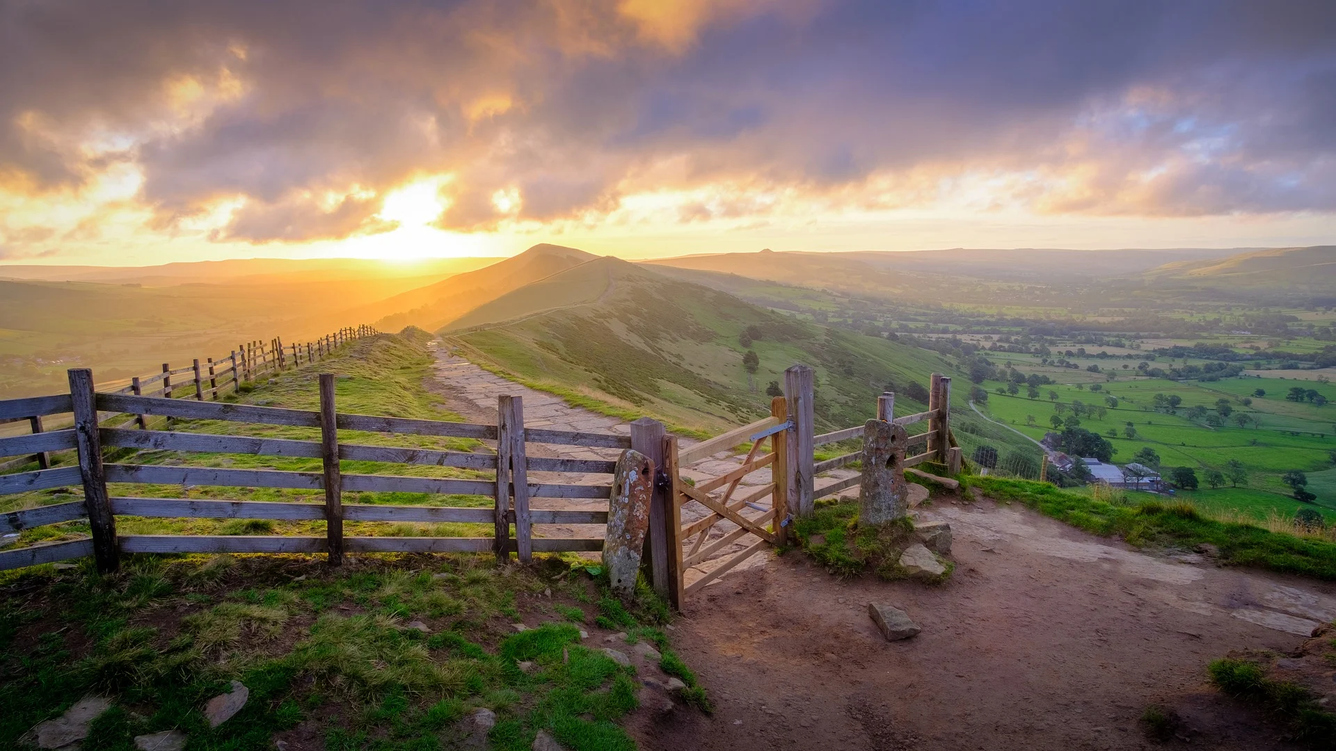
Pennine Way
Edale may be tiny but it’s a gateway to one of the most epic long-distance walks in the UK – The Pennine Way. Stretching for 268 miles from Edale to Kirk Yetholm in the Scottish Borders, the route is England’s first National Trail and passes through some of the country’s most stunning landscapes, including the Derbyshire Peak District, Yorkshire Dales Yorkshire Dales and Northumberland National Park. The Old Nags Head Pub in Edale is the traditional starting point, with a small plaque across the road marking the start of the Pennine Way. Don’t be shy about starting your hike with a pint in the beer garden.
After setting off you’ll quickly warm up as the trail skirts the base of 636-metre-high Kinder Scout moorland plateau and cascading Kinder Downfall, one of the tallest waterfalls in the park. The knee-crunching descent down to Torside reservoir will leave you hungry for dinner in Crowden. Cook up a hearty camp meal or book a bed at the popular Old House B&B. Hike back to Edale the next day or lace up your boots and complete the entire Pennine Way from start to finish. It does require a lot of planning, which can be a joy or a headache depending on your patience. You will need an essential OS map.
Length: 268 miles
Average time to complete: 16 – 19 days
Starting point: Edale/Kirk Yetholm in the Scottish Borders
Derwent Dam and Ladybower Reservoir
While this scenic walk doesn’t start in Edale it’s a stone’s throw from the village and is definitely worth the side trip. You’ll find yourself in one of the most spectacular regions of Peak District National Park, with the trail winding past rolling farmland, wooded valleys and moors. The views are breathtaking, stretching across the Derwent Valley and the Dark Peak region. As well as enormous mountain hares, there’s a good chance of spotting golden plovers and other local wildlife.
Length: 4 miles
Average time to complete: 1.5 hours
Starting point: Fairholmes Car Park
Win Hill Walk
Starting from Heatherdene Car Park, the family-friendly trail up Win Hill treats you to incredible views over the Great Ridge and Ladybower Reservoir. It’s steep but definitely doable with kids, making it a great option if you want to introduce your little ones to the joys of mud, sweat and maybe even a few tears. We like to call it character building.
You’ll start with a gentle ascent through a pine forest before scrambling up some boulders to reach the summit. The descent is a little steeper and it can be a good idea to pack walking poles if you have knee troubles. Snap a photo at the white Triangulation Pillar and enjoy a picnic with a view before heading back down.
Length: 4 miles
Average time to complete: 1.5 hours
Starting point: Heatherdene Car Park
Peveril Castle
Overlooking the village of Castleton and constructed by the son of William the Conqueror, Peveril Castle recalls the ancient history of Peak District. The Norman stronghold dates to the 11th century and boasts an imposing setting among the rugged Cavedale Cliffs. As well as a stronghold for William Peveril, the castle was also commandeered as a Peak District hunting lodge for Henry II, King John and Henry III. Hiking up to the castle is a challenge, with the five-mile walk taking you up a steep ravine. The trail is tough and rocky so it’s best to wear a sturdy pair of boots with good grip.
The return trip takes you past some eerie caves, including Blue John Cavern and Treak Cliff Cavern. Geologists swoon over Blue John, a semi-precious fluorite stone found exclusively in these caverns. Luminescent bands of blue, purple and yellow make the stone a favourite with local jewellers. The village of Castleton is dotted with jewellery stores where you can pick up handmade treasures featuring Blue John.
Length: 5 miles
Average time to complete: 2 hours
Starting point: Castleton Village
Grindslow Knoll via Ringing Roger
Short and sweet, hiking Grindslow Knoll via Ringing Roger will take you around 3.5 hours at a moderate pace. You’ll cover almost six miles, starting on a flagstone path before crossing through a grassy field and starting the ascent up to Ringing Roger, a series of bell-shaped boulders. Follow the path past the enormous stone cairn and on to the Kinder Plateau. Before ascending you’ll veer left, cross a stream and start the climb up to Grindslow Knoll. Pack a chocolate bar to devour at the top, then head back down and consider lunch at the ever popular Old Nags Head Pub.
Length: 6 miles
Average time to complete: 3.5 hours
Starting point: Edale
Edale Skyline
At 24 miles long, Edale Skyline is not for the faint-hearted. You’ll cover more than 4000 feet of elevation as the circuit climbs across the Hope Valley and takes you past some of Peak District’s most iconic landmarks, including Kinder Scout and Mam Tor. Other highlights include summiting Win Hill and feeling sky-high on the Great Ridge, the two-mile-long spine that connects the summits of Mam Tor and Lose Hill.
As you hike along the ridge, you’ll see the steely gritstone hills of Dark Peak to the north and the chalky limestone dales of White Peak to the south. In spring the ridge is carpeted in bright purple wildflowers. For a change of scene, we recommend starting the Edale Skyline in Hope. Finish with a hearty lunch at the Old Hall Hotel and pick up local goodies from Watson’s Farm Shop on your way out the village.
Length: 24 miles
Average time to complete: 12 hours
Starting point: Hope or Edale
Caring for Edale and Peak District National Park
More than 13 million visitors descend on Peak District every year, making it one of the most popular national parks in Europe. While the Peak District National Park Authority does an incredible job at protecting this pristine wilderness, as walkers and wildlife warriors we’re all responsible for doing our part. This means packing out your rubbish, sticking to marked trails and keeping your hands off plants, flowers and wildlife. You may think your footprint is small, but 13 million pairs of boots add up and can have a big impact if people don’t stick to the rules.
Getting to Edale
While many of Britain’s premier hiking and walking destinations can only be accessed with a private vehicle, Edale is different. The village is a key stop on the Hope Valley Line run by Northern Railway, with excellent connections to Sheffield and Manchester. Great if you don’t have access to a set of wheels. Most walks start at the train station, meaning you can literally step out of your carriage and start hiking. As well as Edale, Hope Valley Line trains call at Bamford, Hope, Hathersage and Grindleford, where you’ll also find some bucket list-worthy hikes. If that doesn’t take your fancy, check out our further guides for walking routes across the UK.
Of course, driving is also an option. There’s a good sized car park in the main village though it can fill up fast in the busy summer months. Street parking is extremely limited so you may need to use the train station car park or the overflow car park a short walk from the village centre.
Happy hiking!